How is Earthquake Magnitude Measured?
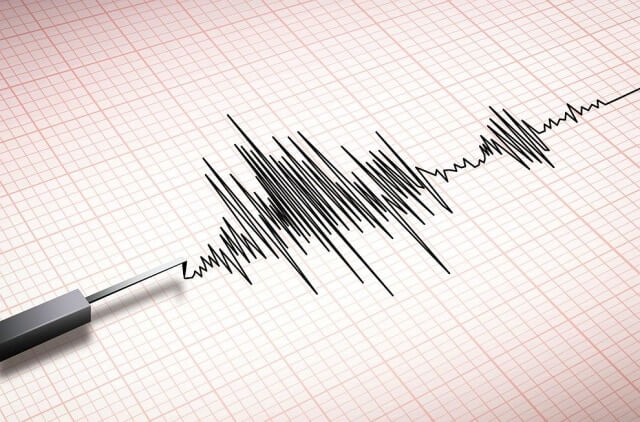
The magnitude of an earthquake is measured by a machine called a seismometer. A seismometer produces a seismograph. According to the Earthquake Glossary, a seismograph is defined as “an instrument used to detect and record earthquakes. Generally, it consists of a mass attached to a fixed base. During an earthquake, the base moves and the mass does not. The motion of the base with respect to the mass is commonly transformed into an electrical voltage. The electrical voltage is recorded on paper, magnetic tape, or another recording medium. This record is proportional to the motion of the seismometer mass relative to the earth, but it can be mathematically converted to a record of the absolute motion of the ground.” In simple terms, a seismograph measures the amount that the earth shakes, converted into a recording medium, such as paper. The magnitude reading is measured on something called a Richter scale. The Richter scale is normally numbered 1 through 10, but there is actually no upper limit. The world’s largest documented earthquake hit 9.5, so up to this point, there has been no need to show numbers larger than 10.Which Earthquake Had The Largest Magnitude Ever Recorded?
In 1960 near Valdivia, southern Chile, the earth shook like never recorded. It has been revered as the “Great Chilean Earthquake” and had the largest recorded magnitude ever, measured by the United States Geological Survey as a 9.5 on the Richter scale. The destruction caused by an earthquake of this magnitude was nearly unimaginable. It left 2 million people homeless. Three thousand people were injured in addition to nearly two thousand deaths. The total damages to the country financially were between 3 and 6 billion dollars (adjusted to the monetary amount in 2020). Even more than this, the Valdivia earthquake was so massive that it triggered a tsunami through the Pacific. The waves from this tsunami attacked coastal villages in New Zealand, Japan, the Philippines, and Hawaii, where still, more lives were lost. Below is a list of the largest earthquakes we have seen It is important to note that we have only been recording magnitude on the Richter scale since its development in 1935, so that following list consists of the world’s most recent earthquakes:1960: Chile. 9.5 on the Richter scale. Killed 1655 in Chile. The subsequent tsunami killed 68 in Hawaii, 138 in Japan and 32 in the Philippines.
1964: Alaska. 9.2 on the Richter scale. Killed 15. The subsequent tsunami killed 113.
2004: Indonesia. 9.1 on the Richter scale. The tsunami killed almost 230,000 around the world.
1952: Hawaii. 9.0 on the Richter scale. No deaths.
1906: Ecuador. 8.8 on the Richter scale. The tsunami killed up to 1500 in Ecuador and Colombia.
1965: Alaska. 8.7 on the Richter scale. No deaths.
2005: Indonesia. 8.6 on the Richter scale. More than 1300 killed.
1950: Tibet. 8.6 on the Richter scale. Killed about 780.
1957: Alaska. 8.6 on the Richter scale. No deaths.
2007: Indonesia. 8.6 on the Richter scale. 25 or more people killed.
How is Earthquake Intensity Measured?
And now to the second part of the equation of measuring earthquakes: their intensity. Measuring an earthquake through intensity is actually fairly simple. The intensity of an earthquake is based on the amount of damage it causes. You can’t always expect the same amount of damage using magnitude as your only measurement. For example, there could be a 4.1 magnitude earthquake, 10 miles deep under the earth, and most people will not even feel it. Because of this, little to no damage will result. On the other hand, if that same magnitude of an earthquake occurs only one mile deep, there will obviously be increased damage on the earth’s surface. The effect of the earthquakes for communities, cities, and states is converted into a number to measure its intensity. The damage was done by the earthquake in Chile, for example was massive. Lives were lost, tsunamis created, hoards of people displaced, many injured, and countries financially buried. All damage from an earthquake, such as the measures in the example given above, is surveyed and considered when measuring intensity.
How Hard Is It To Predict An Earthquake?
Predicting an earthquake is nearly impossible. We know that earthquakes are created by the movement of the tectonic plates, and so earthquakes occur near fault lines of these tectonic plates. Miles below the surface, an earthquake is preceded by a rupture of rocks. It is extremely difficult to understand how rocks behave under the increased pressure and temperature found at varying levels under the earth’s surface. They all do, however, have a characteristic pattern of starting with tremors, increasing in magnitude in a linear matter, peaking, and then decreasing in magnitude in a linear pattern. There is no way of knowing where the peak will occur, what the magnitude will become, or when the earthquake will begin. Experts have attempted collecting samples by drilling into fault zones. This is not cost-effective, is difficult to do, and to date has not shown much progress in research trying to understand earthquakes better. In the past, scientists have tried to recognize patterns. A few have been noted, although these are fairly sporadic and hardly indicative of a coming earthquake. At times, earthquakes are preceded by changes in the environment, such as:- Changes in the groundwater level
- An increase in radon gas concentrations
- Changes in electromagnetic activity
- Foreshocks
- Measurable ground deformations
- Geochemical changed in groundwater
- Unusual animal behavior
Can Earthquakes Be Prevented?
Natural earthquakes cannot be prevented. However, several human activities can trigger them. If we cease to do these things, we can hopefully bring a stop to man made earthquakes. A few of these activities include- Impoundment of reservoirs
- Surface and underground mining
- Withdrawal of fluids and gas from the surface
- Injection of fluid unto underground formations